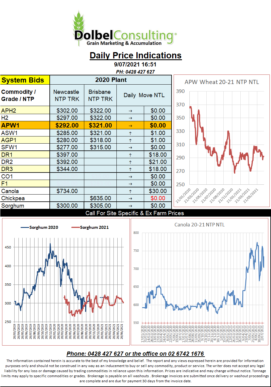
9/7/21 Prices

There’s been nothing more than some very isolated storms across central Saskatchewan over the last week and even those storms are dropping a lot less moisture than they were predicted to. Yesterday storms around Saskatoon were expected to produced localised falls of 50 -100mm but a quick look at recorded totals and those that received more than 10mm are on the high side.
The forecast for the Canadian Prairies, and to a lesser extent the US spring wheat belt, have both been amended to reflect a drier 7 days ahead. Saskatchewan may see some falls of 10-20mm around Monday but the map is generally suggesting these falls may be towards the northern edge of the durum belt.
In the US heat is expected to return to the HRWW belt and temperatures could move into the high 30sC as far north as the Montana / Saskatchewan border by the end of next week.
France and Germany continue to see good rainfall with some heavier falls across the durum wheat regions of central south France. The next week is expected to be drier and should assist. Drier weather is predicted to arrive across parts of southern Russia and eastern Ukraine over the next week. After a generally wet week the dry conditions will be welcome as harvest tries to steam ahead. Showers are predicted across the spring wheat region of Russia and Kazakhstan next week after what has been a less than ideal season to date. This may be a case of too little too late, similar to what we are seeing unfold in the US and Canadian spring wheat regions. Where’s our big APH spreads.
